What was once lush and thriving
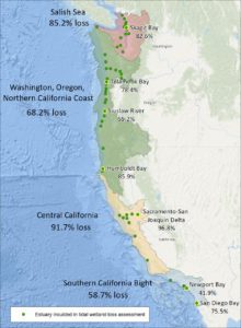
A groundbreaking report recently published by NOAA and its partners uses new technology and data to determine that West Coast estuaries have lost nearly 85% of their historical acreage.
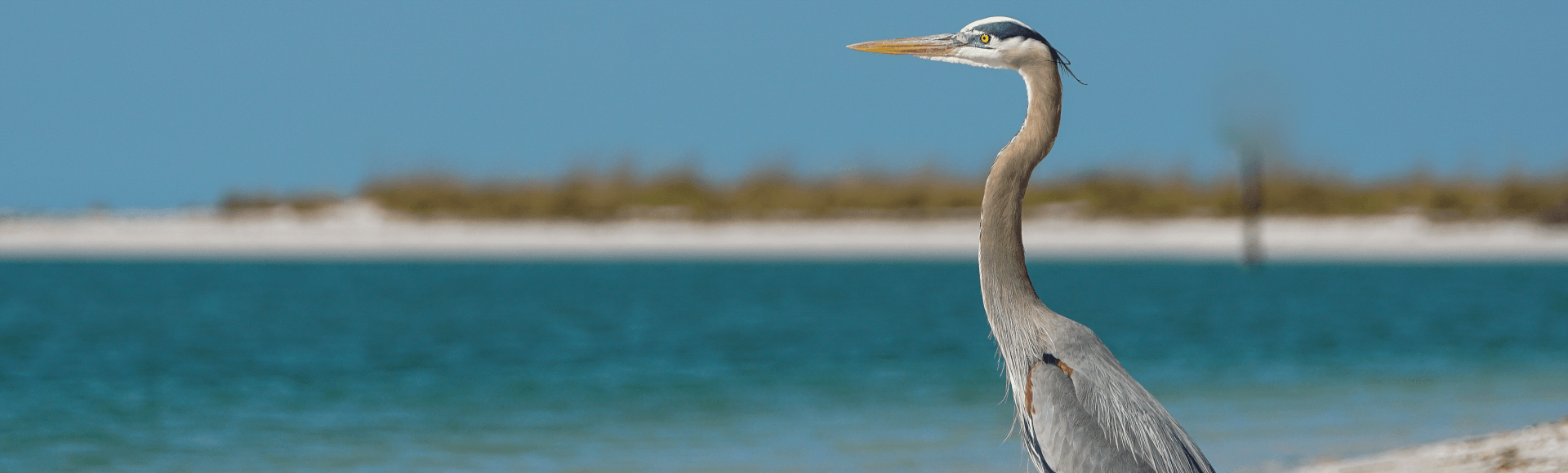
According to the study, estuaries in California, Oregon, and Washington once covered nearly 2 million acres, an area three times the size of Rhode Island. As humans began altering and developing the land in the early 1800s to support the Industrial Revolution, the size of these tidelands drastically decreased. This lush tidal vegetation supports an array of birds and wildlife, and serves as critical nursery habitat for juvenile salmon and steelhead making their way from freshwater to the sea.
To conduct this research, scientists used lasers that measure reflected light, known as Lidar, and compared the results with digital water elevation models provided by NOAA to map the contours and historic reach of the tidelands. This is the first time methodologies of this type have been used across all 450 estuaries of the contiguous US West Coast.
The study concluded that San Francisco Bay has lost nearly 83% of its historic wetlands, while the Columbia River estuary has lost about 74%.
“We now have a new and considerably more accurate measure of the historical extent of these estuaries,” said Laura Brophy, director of the estuary technical group at the Oregon Institute for Applied Ecology and the lead author of the study.
This study opens the door to new restoration potential as well. Habitats that had long ago been drained for agricultural purposes have become densely forested; what may have once been overlooked have now been identified as former wetlands and tagged for possible restoration.
“By folding in these areas that may not have been recognized as part of estuaries, we have a better idea of just how important and extensive these estuaries were,” Brophy said. “Now we can see new restoration opportunities that people didn’t realize existed.”
The authors of the study include researchers from NOAA Fisheries’ Northwest Fisheries Science Center, the Institute for Applied Ecology, Pacific States Marine Fisheries Commission, Oregon Department of Land Conservation and Development, The Nature Conservancy, Moss Landing Marine Labs, and Pacific Spatial Solutions. The project was coordinated by the Pacific Marine and Estuarine Fish Habitat Partnership.
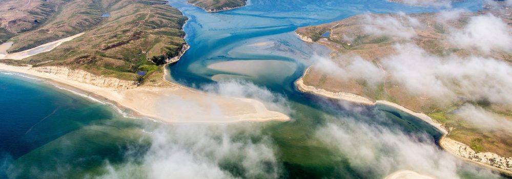
Cover Photo: Aerial view of Drakes Bay in Point Reyes, CA. courtesy of NOAA. | Inset: Habitat loss map, courtesy of NOAA.
